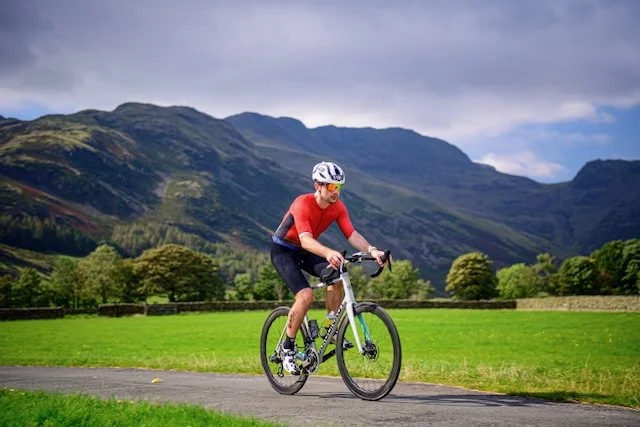
Cycling Scotland’s NC500: The ultimate biking guide to the North Coast route
Your 8 day North Coast 500 biking itinerary, guide and map
Scotland’s North Coast 500 isn’t just one of the UK’s most iconic road trips, it’s also an epic challenge for cyclists ready to take on windswept coastlines, dramatic climbs, and jaw-dropping views at every turn.
In this free 8-day cycling NC 500 guide, I’ve adapted my original 6-7 day driving route into a two-wheeled adventure, carefully planned for riders averaging 60–80 miles a day. You’ll cycle quiet coastal roads, conquer legendary climbs like Bealach na Bà, and explore wild corners of the Highlands that most travellers only ever drive through.
Whether you're chasing remote white sandy beaches, castle views or rolling hills this itinerary blends the best of the NC500 with manageable daily distances and unforgettable scenery.
Ready to saddle up? Let’s ride.
Thinking of driving the NC500 by car instead of cycling? 🚗 Check out my dedicated guide: NC500 by car and van guide.
What’s inside this free 8 day NC500 cycling route guide:
Click to jump to a section


📍Planning your 8 day NC500 cycling itinerary
Tackling the NC500 by bike adds a whole new layer of adventure, but it also means a bit more planning, especially when it comes to accommodation and daily stops.
🚴 Accommodation & Campsites along the NC500
If you’re staying in campsites or B&Bs, it’s a good idea to book ahead, especially in the summer months (June to August) when spots fill up quickly. Even in shoulder season (like May), the most scenic campsites (and those with bike-friendly facilities or electric pitches) can be booked up by late afternoon. Some cyclist-friendly hostels and bothies are also worth looking into, just check they’re open and accessible. My favioewute is the Sango Sands Campsite in Durness, it offers incredible facilities and views!
🚐 Planning Overnight Stops (for van support or bikepacking)
If you’ve got a support vehicle or you're wild camping, make sure to plan your overnight stops carefully. Many popular lay-bys and picnic spots fill up early, especially those with views or near beaches. And some areas now have wild camping restrictions or require permits, so research is key.
Extra cycling resources to help you plan, prep and pedal the NC500 with confidence:
Download the full NC500 cycle route—broken into daily legs with distances, gradients, elevation profiles, GPX files, and bike-friendly stops. Built by cyclists, for cyclists.
Get the guide →View the route in map format with bike shops, water refill points, cafes, scenic photo stops, and emergency access markers—all optimised for touring by bike.
Explore the map →🗺️ NC500 cycle route and map
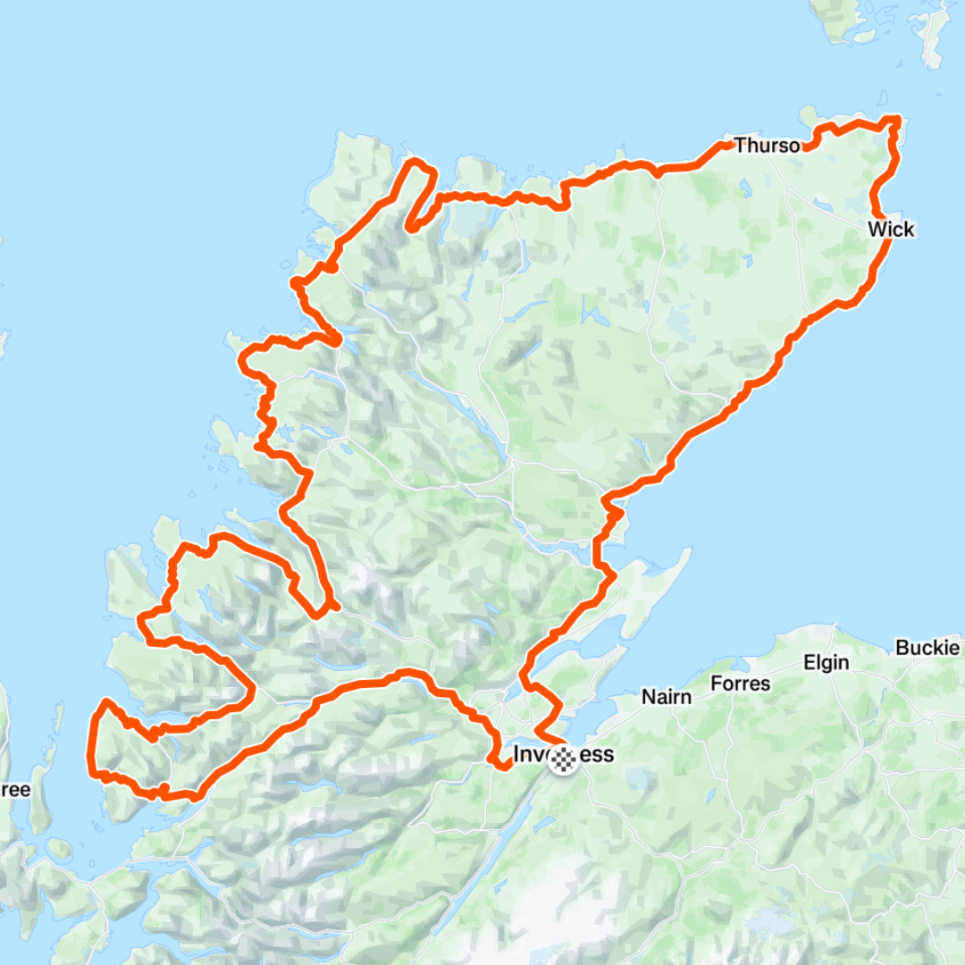
NC500 Cycling Route Map
The North Coast 500 forms a scenic loop around the northern Highlands of Scotland. Starting and finishing in Inverness, it covers just over 500 miles (805 km), though your 8-day cycling route averages 60–75 miles per day.
Key highlights include dramatic coastal roads, wild mountain passes, iconic landmarks, and the legendary Bealach na Bà climb.
Scroll down for the full GPX file and Google Map route.
Where to start your NC 500 cycling adventure
The official North Coast 500 route starts and finishes in Inverness, the capital of the Scottish Highlands, and it's the perfect launch point for cyclists too.
🚆 Getting to Inverness
By Train: Direct trains run from Edinburgh, Glasgow, and London (including the Caledonian Sleeper).
By Car: If someone’s dropping you off, there’s plenty of long-stay parking around the city outskirts. Several car hire companies in Inverness offer a range of vehicles to suit different budgets and needs. Some of the most popular car hire companies in Inverness include:
Avis Car Rental
Enterprise Rent-A-Car
Europcar
Hertz Rent A Car
By Air: Inverness Airport offers domestic and some international flights, with bike-friendly taxi options available into the city.
🚲 Starting point in Inverness
Most cyclists begin the route at Inverness Castle, where the Scotland NC500 officially starts. It’s centrally located and makes for a great photo op before you hit the road. There are bike shops, supermarkets, and cafés nearby if you need any last-minute supplies.
🔁 Clockwise or anti-clockwise?
This guide follows a clockwise route and for good reason:
You’ll get gentler east coast roads first to warm up
You’ll reach the Bealach na Bà climb early in the trip, when your legs are ready for a big climb
It’s the direction favoured by many cyclists due to prevailing wind patterns
Accommodation when cycling along the North Coast 500
When cycling the NC500, where you stay each night plays a big part in how enjoyable (and comfortable) your trip is, especially after a long day in the saddle. Whether you're wild camping, using a support vehicle, or booking accommodation in advance, it's worth planning each stop in advanced.
🚲 Camping & campervan Support
If you're lucky enough to have a support campervan following your ride, you'll have a bit more freedom in terms of overnight options. The app Park4Night is a brilliant tool for finding campervan-friendly spots along the route, including roadside lay-bys, beach pull-ins, and full-facility campsites.
That said, many other travellers use the app too, so the most scenic stops can fill up by late afternoon. If your camper is supporting multiple riders, it’s a good idea to arrive early and secure a space, especially near hotspots like Durness, Achmelvich, and Applecross.
🏕️ Tent camping & wild camping
If you're bikepacking and carrying your own gear, Scotland’s wild camping laws give you some flexibility, as long as you’re respectful of the environment, pitch away from roads or buildings, and follow Leave No Trace principles.
Some of the best wild camping spots we found were:
Near beaches like Balnakeil, Big Sand (one of the most beautiful), and Strathy Bay
Lochside pitches outside smaller villages
Campsites are also dotted along the route and can be a great way to enjoy hot showers, dry kit, and stock up at on-site shops. Booking ahead during peak season (June–August) is highly recommended.
🏨 B&Bs, Hostels, and Guesthouses
For those travelling light or just wanting a comfy bed and a proper breakfast, there are plenty of bike-friendly B&Bs and hostels along the NC500. Many have secure bike storage, drying rooms, and friendly hosts happy to help with refilling bottles, making packed lunches, or sharing local knowledge.
Wherever you choose to stay, the key is: plan ahead, be flexible, and book early if possible.


Ultimate NC500 cycling Itinerary
〰️
Ultimate NC500 cycling Itinerary 〰️
8 day North Coast 500 cycling itinerary, map and GPX
This 8-day North Coast 500 cycling itinerary breaks down the full route into manageable daily stages, covering over 500 miles of epic coastline, mountains, beaches, and wild Highland scenery.
Below you’ll find a full route map, daily highlights, and a downloadable GPX file to help you stay on track. Whether you’re bikepacking solo or riding with support, this guide is designed to help you make the most of every mile.
Day 1: Inverness to Lochcarron
Distance: 73 miles / 117 km
Elevation Gain: ~1,200 metres
Estimated Ride Time: 4 hours (5.5 hours including stops)
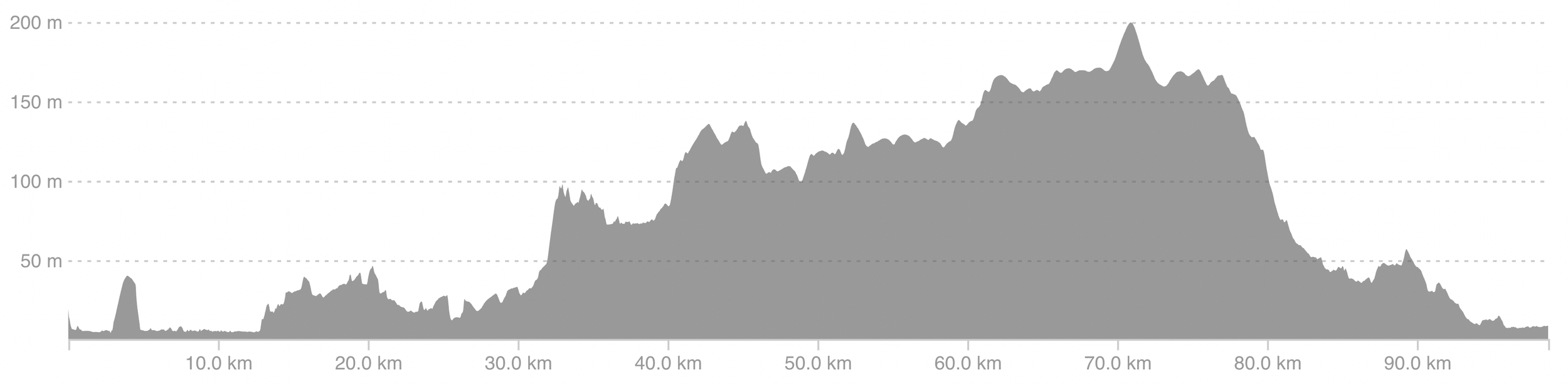
Day 1 NC500 route elevation

Day 1 North Coast 500 cycling itineracy

Day 1 North Coast 500 cycling route
🌄 Morning – Leaving Inverness
Kick off your NC500 cycling adventure from Inverness Castle, following quiet roads west through Beauly and Muir of Ord. The first 15–20 miles are rolling and relatively gentle, a great way to warm up the legs.
Good stops in the morning:
Velocity Bicycle Café in Inverness – coffee and last-minute kit check
Highland Bikes – useful for any final mechanicals or spare parts
The scenery quickly opens up as you head through farmland and forests, with distant glimpses of the Highlands beginning to show. Keep a steady pace, the hills build gradually as you ride deeper into the west.
🍽️ Afternoon – Into the Highlands
As you ride toward Achnasheen and Strathcarron, the landscape becomes more dramatic, wide valleys, rivers, and towering ridgelines on the horizon. You’ll feel the wildness of the west coast creeping in.
Afternoon highlights:
Scenic picnic spots near Loch a’ Chuilinn and Loch Dughaill
Lunch in Lochcarron: Waterside Café or the Albatross Café for lochside views and a decent bite to eat
This final stretch is lumpy but rewarding, with short climbs followed by flowing descents. Expect a few punchy gradients above 10%, but nothing too sustained. Take your time and enjoy the scenery.
🌙 Evening – Settle into Lochcarron
You’ll roll into Lochcarron with the loch glittering to your right and mountains on all sides. It’s a peaceful place to end the day and rest before the climb over Bealach na Bà on Day 2.
Accommodation options:
Rockvilla Guest House – A seafront B&B with bike-friendly hosts, comfy rooms, and stunning views across Loch Carron.
Lochcarron Hotel – A relaxed pub-style hotel on the shore offering dinner, drinks, and secure bike storage.
Lochcarron Campsite – A simple and scenic camping spot just outside the village, with pitches for tents and a few electric hook-ups. Ideal for bikepackers and van-supported riders.
The Wee Campsite – A small, peaceful site within walking distance of the village centre. Great for wild camping vibes with basic facilities.
Glamping Pods at Lochcarron – Perfect if you want a roof over your head without giving up the minimalist adventure feel.
A short stroll along the loch after dinner is a great way to stretch your legs before resting up.
🎯 Top tip for day 1
Fill up on water before leaving Inverness, services become sparse between Muir of Ord and Lochcarron. Also, keep an eye on your average speed to avoid rolling into camp too late. Sunset views over the loch are worth catching.


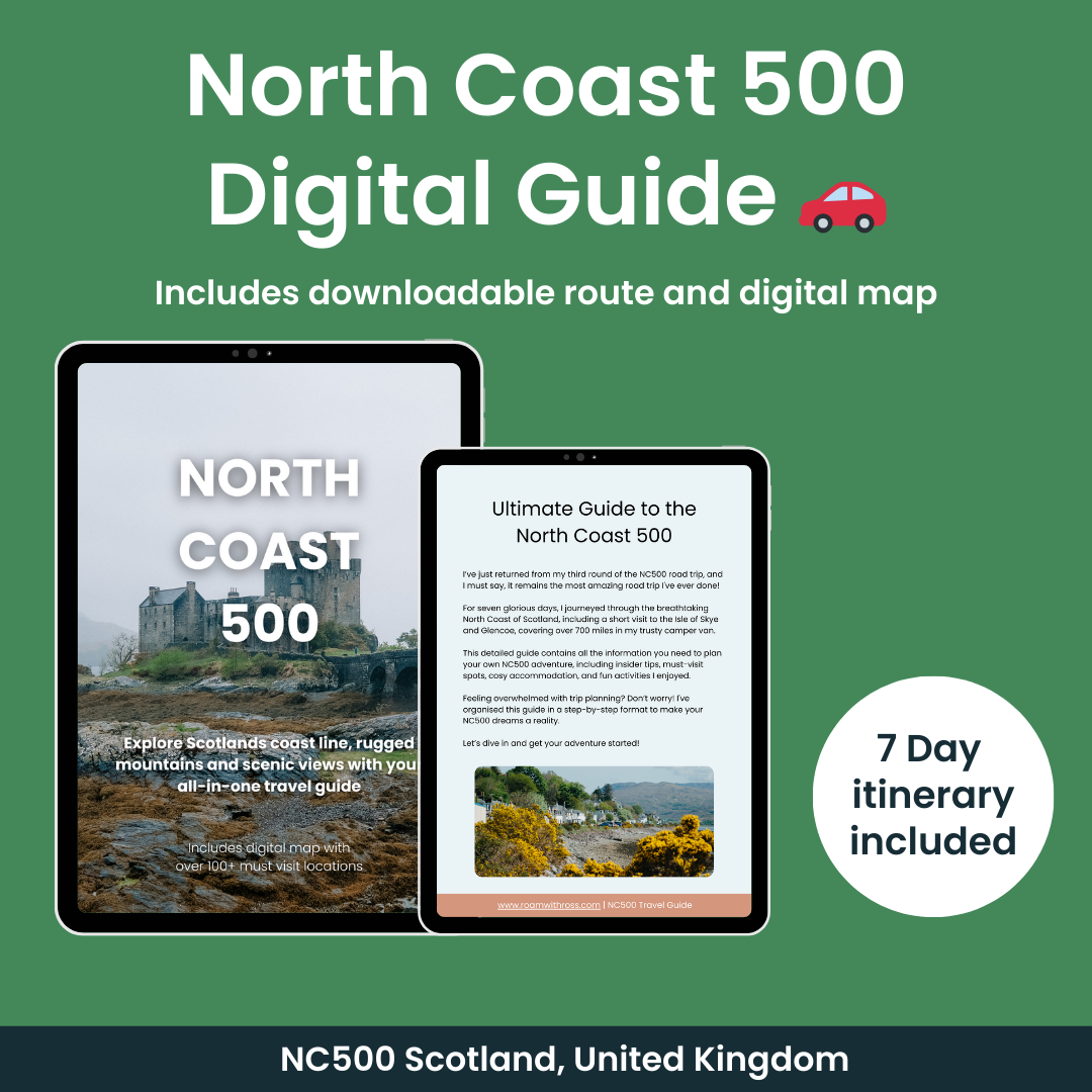
🌊 Turn your 2026 NC500 plans into reality
Dreaming of exploring Scotland’s iconic North Coast 500? My downloadable Guide & Interactive Map gives you everything you need to plan an unforgettable 2026 road trip. 🚗
Discover the best stops, hidden viewpoints, cosy stays and stunning beaches – all mapped out with a free Google Map featuring 100+ handpicked locations. 📱
Prefer a more personal touch? Order the printed guide or get a custom itinerary crafted just for your 2026 adventure. 🗺️
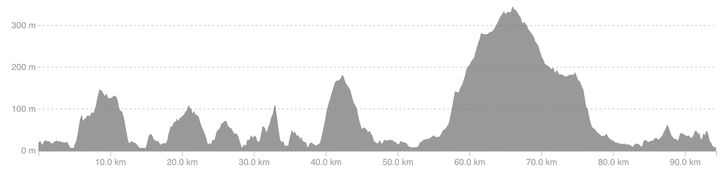
Day 2: Lochcarron to Big Sand via Bealach na Bà, Applecross & Torridon
Distance: 82 miles / 135 km
Elevation Gain: ~1,750 metres
Estimated Ride Time: 6–7 hours (8+ with stops)
NC500 Day 2 route elevation

Day 2 NC500 itinerary

Day 2 route along the NC500
🌄 Morning – Conquer Bealach na Bà
After an early start from Lochcarron, you’ll hit one of the most iconic climbs in the UK, Bealach na Bà. This alpine-style road winds up to 625 metres over 9 km, with multiple switchbacks and gradients reaching 20%.
Morning Highlights:
Bealach na Bà Viewpoint – take a breather and snap a photo. On a good day you can see the Isle of Skye in the distance.
Applecross Village – great spot for coffee, pint or second breakfast by the water front
Try: The Walled Garden Café or the Applecross Inn for a mid-morning bite

Cloud Inversions at Bealach Na Ba looking out to Isle of Skye
The descent from Bealach na Bà viewpoint is incredible, fast, flowing and scenic. From Applecross, hug the coastline on remote single-track roads, passing wild bays and glimpses of the sea.

Looking up at Bealach na Ba
🍽️ Afternoon – Torridon & Kinlochewe
This section includes multiple steep ramps and sweeping views of the Torridon mountains.
Recommended stops:
Shieldaig – small shop and bar for snacks or lunch
Torridon Stores & Café – perfect for coffee, cake or resupplying
Kinlochewe – quick water stop before the push toward Gairloch
The A832 climbs gently out of Kinlochewe before a long descent alongside Loch Maree, this part is stunning, especially with the light bouncing off the water.
🌙 Evening – Arrive at Big Sand
Big Sand is about 10 minutes north of Gairloch, and well worth the extra miles. You’ll ride past golden beaches and quiet coastal lanes before reaching one of the best campsites on the west coast.
Dinner options:
Gairloch town (20 mins backtrack or en route):
The Old Inn - cosy pub grub
Gairloch Fish Bar – classic chippy takeaway
Coast Coffee Company – lighter meals and good coffee

One of my favourite sunsets along the NC500
-
🔓 To unlock this part of the guide, you need to either purchase the NC500 Cycling Guide or become a Roam with Ross member.
Members get full access to:
✅ The complete day-by-day breakdown
✅ Downloadable GPX files
✅ Elevation profiles
✅ Exclusive wild camping spots
✅ Bonus tips and hidden detoursJoin today for just £4.99/month and get unlimited access to this and all future cycling and hiking guides.
👉 Not yet? [Become a member now] and start planning your adventure. -
🔓 To unlock this part of the guide, you need to either purchase the NC500 Cycling Guide or become a Roam with Ross member.
Members get full access to:
✅ The complete day-by-day breakdown
✅ Downloadable GPX files
✅ Elevation profiles
✅ Exclusive wild camping spots
✅ Bonus tips and hidden detoursJoin today for just £4.99/month and get unlimited access to this and all future cycling and hiking guides.
👉 Already a member? [Log in here]
👉 Not yet? [Become a member now] and start planning your adventure.
🎯 Top Tip for Day 2
Stock up on food in Gairloch before you roll into Big Sand, there are limited facilities once you're at the campsite, especially in the evening. This is also a great evening to do laundry or charge devices, as the site has proper facilities.


Day 3: Big Sand to Ullapool
Distance: 60 miles / 95 km
Elevation Gain: ~1,050 metres
Estimated Ride Time: 4–5 hours (6 with breaks)
Day 3 NC500 route elevation

Day 3 NC500 cycling route itinerary

Day 3 NC500 cycling route map
🌄 Morning – Coastal Cruise to Poolewe and Gruinard Bay
Start your day by riding back inland from Big Sand and rejoining the A832 toward Poolewe. This stretch offers a mix of forested lanes and open coast, easy on the legs and a visual treat.
Morning Highlights:
Poolewe Village – stock up at the small shop or grab a coffee at the Bridge Café
Inverewe Garden & Estate – a short detour for those keen on botanical wonders
Gruinard Bay Viewpoint – sweeping views over red sand beaches and rugged headlands
This section includes rolling climbs and descents, but nothing overly steep. It’s a great day to enjoy the rhythm of the road.
🍽️ Afternoon – Sweeping Roads to Ullapool
From Gruinard Bay, continue along the A832 which winds gently inland through Dundonnell, then follows the edge of Little Loch Broom. The scenery here is wild and remote — some of the most peaceful riding of the entire trip.
Good stops:
Dundonnell Hotel – ideal for a quick bite or coffee
Ardessie Falls – a great photo spot and short walk just off the roadside
Laybys along Little Loch Broom – perfect for a snack break
The final climb of the day leads you up and over the hill before descending into Ullapool, a vibrant harbour town with cafés, pubs, and a well-earned buzz.
🌙 Evening – Rest and Refuel in Ullapool
Ullapool is one of the larger towns on the NC500 route and has everything you need: bike shops, laundry, restaurants, and a well-stocked supermarket.
Where to eat and drink:
Seafood Shack – legendary for fresh, local catches
The Arch Inn – pub with live music and hearty meals
Deli-Ca-Sea – casual fish and chips on the go
Tea by the Sea – a sweet spot for coffee and cake
-
Broomfield Holiday Park – right by the loch, popular with cyclists and campervans
Creagan Guest House – central, bike-friendly B&B with great breakfast
The Ceilidh Place – hotel, restaurant and bookshop all in one, very popular with touring cyclists
Ullapool Youth Hostel – affordable and sociable with secure bike storage
-
🔓 To unlock this part of the guide, you need to either purchase the NC500 Cycling Guide or become a Roam with Ross member.
Members get full access to:
✅ The complete day-by-day breakdown
✅ Downloadable GPX files
✅ Elevation profiles
✅ Exclusive wild camping spots
✅ Bonus tips and hidden detoursJoin today for just £4.99/month and get unlimited access to this and all future cycling and hiking guides.
👉 Already a member? [Log in here]
👉 Not yet? [Become a member now] and start planning your adventure.
🎯 Top Tip for Day 3
Use Ullapool to recharg, literally and figuratively. Stock up on food, do any laundry, and check your bike over. There are few services between here and Thurso, so this is one of the best resupply points on the whole loop.
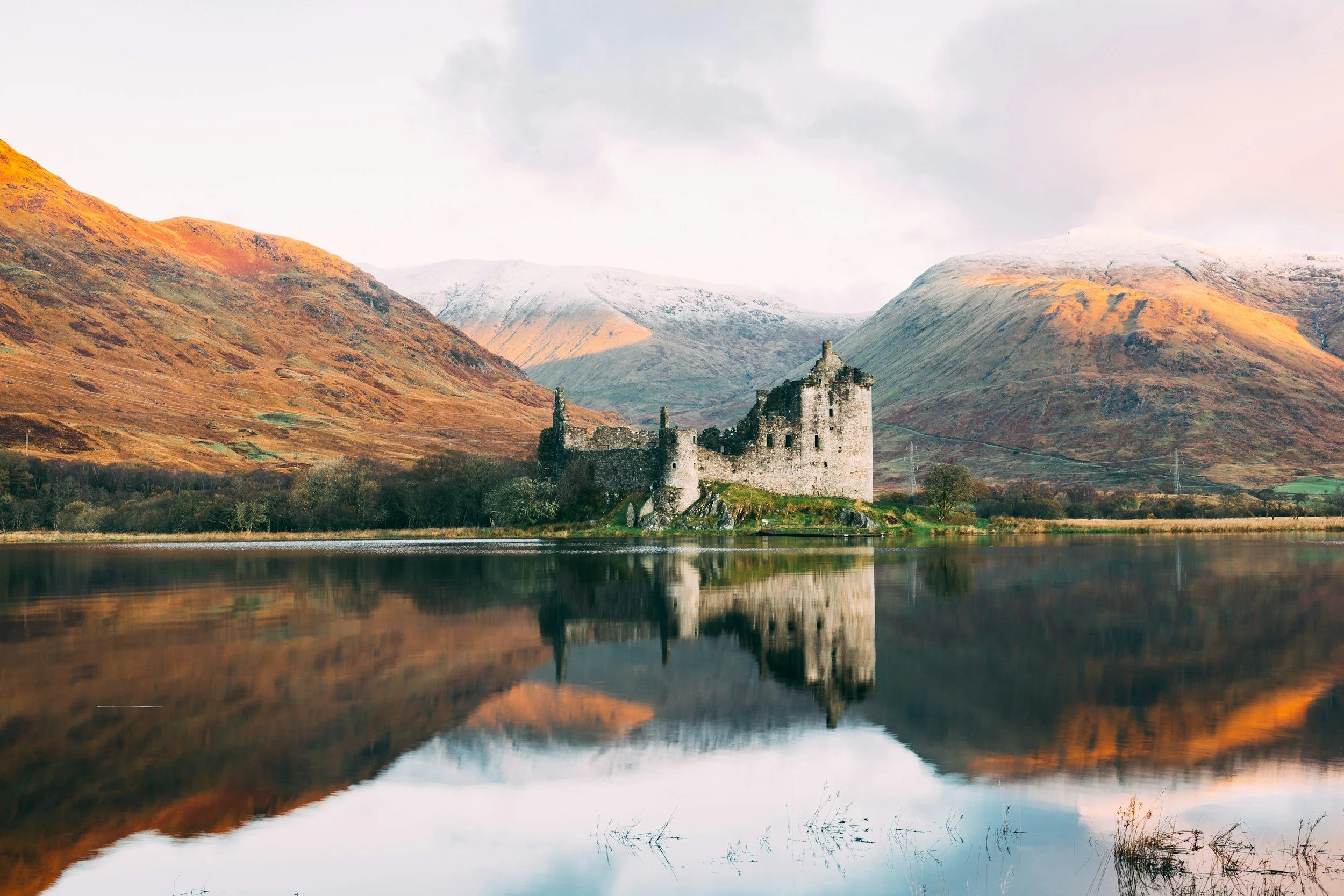
Day 4: Ullapool to Lochinver via Ardvreck Castle & Achmelvich Beach
Distance: 40 miles / 65 km
Elevation Gain: ~950 metres
Estimated Ride Time: 3–4 hours (5+ with stops and swims!)

Day 4 NC500 route elevation

Day 4 NC500 cycling itinerary

NC500 Day 4 cycling route
🌄 Morning – Heading North on Quiet Roads
Leaving Ullapool, the route joins the A835 past Loch Broom, winding steadily north toward Ledmore Junction. The terrain is open and rolling, with long views across moorland and distant peaks.
Morning Highlights:
Ardmair Bay – a peaceful photo stop early in the day
Ledmore Junction – where you turn west towards Loch Assynt
Ardvreck Castle – dramatic 15th-century ruins on the edge of the loch (ideal rest stop)

Ardvreck Castle
🏖️ Afternoon – Assynt’s Coast & Hidden Beaches
From Ardvreck, follow the A837 to Lochinver, with short climbs and sweeping descents. You’re now deep in the wilds of Assynt — one of the most jaw-dropping areas in the Highlands.
Optional detour:
Achmelvich Beach – a 4-mile out-and-back (8-mile total) detour from Lochinver, but totally worth it for a swim and white-sand views
Food & Drink:
Lochinver Larder – famous for its handmade pies
Peet's Restaurant – great coffee and seafood
An Cala Café – casual, cyclist-friendly lunch stop
🌙 Evening – Resting in Lochinver
Lochinver is a peaceful fishing village with a mix of hostels, pods, and wild camping spots. It’s a great place to reset before the next push north into even wilder country.
Accommodation Options:
Suilven View Pods – ideal for bikepackers wanting a bit more comfort
Lochinver Hostel – budget-friendly and sociable
Achmelvich Beach Campsite – if you opt for the detour, pitch up right by the sea
Various B&Bs in the village, many with bike storage available
🎯 Top Tip for Day 4
Take the Achmelvich detour. It adds a bit of distance, but it’s one of the most beautiful beaches in Scotland — and the icy dip will do wonders for tired legs.
-
🔓 To unlock this part of the guide, you need to either purchase the NC500 Cycling Guide or become a Roam with Ross member.
Members get full access to:
✅ The complete day-by-day breakdown
✅ Downloadable GPX files
✅ Elevation profiles
✅ Exclusive wild camping spots
✅ Bonus tips and hidden detoursJoin today for just £4.99/month and get unlimited access to this and all future cycling and hiking guides.
👉 Already a member? [Log in here]
👉 Not yet? [Become a member now] and start planning your adventure. -
🔓 To unlock this part of the guide, you need to either purchase the NC500 Cycling Guide or become a Roam with Ross member.
Members get full access to:
✅ The complete day-by-day breakdown
✅ Downloadable GPX files
✅ Elevation profiles
✅ Exclusive wild camping spots
✅ Bonus tips and hidden detoursJoin today for just £4.99/month and get unlimited access to this and all future cycling and hiking guides.
👉 Already a member? [Log in here]
👉 Not yet? [Become a member now] and start planning your adventure.

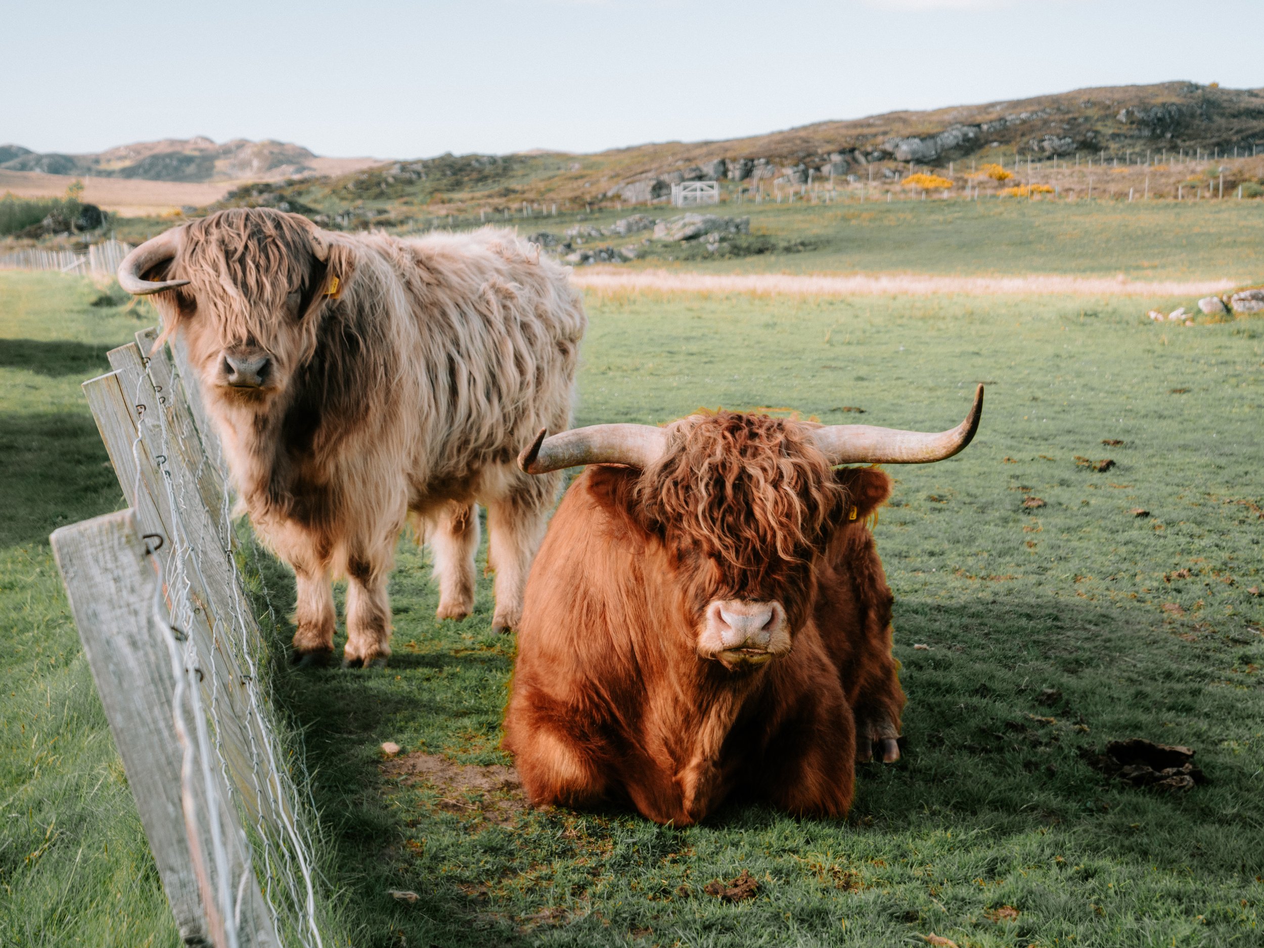
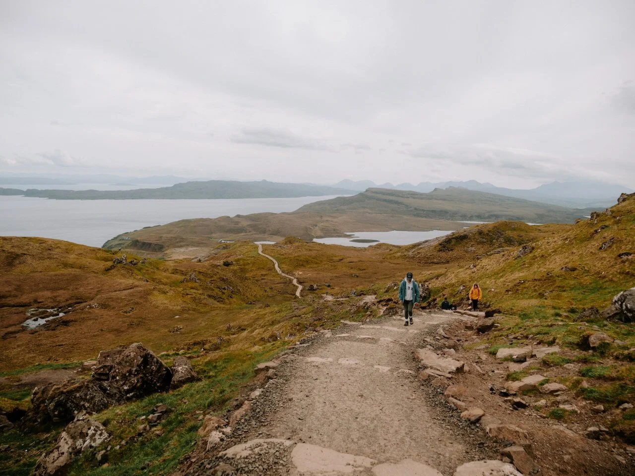
Highland coos at Big Sand Beach
Day 5: Lochinver to Rhiconich via Drumbeg & Kylesku Bridge
Distance: 44 miles / 70 km
Elevation Gain: ~1,200 metres
Estimated Ride Time: 4–5 hours (6 with stops and photos)

Day 5 cycling route elevation

Day 5 NC500 Cycling map route

Day 5 NC500 Cycling map route
🌄 Morning – Into the Wild: Drumbeg Loop
Today’s ride follows the famous Drumbeg Loop, a single-track rollercoaster road with constant short climbs and sweeping sea views. It’s challenging but unforgettable.
Morning Highlights:
Stoer Lighthouse (optional short detour) – dramatic cliffs and a great early stop
Drumbeg Viewpoint – wide coastal views, ideal for a mid-morning break
Drumbeg Stores – tiny local shop with snacks and a community feel
Expect countless small hills (some over 15% gradient), narrow roads, and barely any traffic. Be ready to stop often — not just to catch your breath, but to take in the scenery.
🍽️ Afternoon – Kylesku Bridge and Inland Riding
After Drumbeg, the route turns inland and passes through forested glens before climbing towards Kylesku Bridge — one of the most photogenic spots on the NC500.
Good places to stop:
Kylesku Hotel – excellent lunch or coffee stop with outdoor seating and loch views
Scenic viewpoint at the bridge – don’t miss the photo stop!
Waterfalls near Unapool – small signs point to short walks off the roadside
From Kylesku, it’s a quieter stretch toward Rhiconich, with long glides across lochside valleys and far fewer steep ramps. The wild feeling only grows as you head north.
🌙 Evening – Arrive at Rhiconich
Rhiconich is a tiny hamlet at the junction of two rivers and lochs — peaceful, remote, and a great base before tackling the far north coast.
Accommodation Options:
Rhiconich Hotel – simple but cyclist-friendly, with meals available on-site
Wild camping – there are flat pitches near the water with incredible views
Shepherd’s huts & cabins – a few private stays are listed nearby if booked in advance
Kinlochbervie (5 miles further) – small village with a shop and extra accommodation
There aren’t many dining options here, so make sure to grab dinner at your accommodation or carry food if camping.

Looking over the Scottish Highlands, Beinn Eighe
Day 6: Rhiconich to Melvich via Durness, Smoo Cave & Strathy Bay
Distance: 70 miles / 110 km
Elevation Gain: ~1,000 metres
Estimated Ride Time: 6–7 hours (7+ with stops)

Day 6 NC500 cycling route elevation

Day 6 NC500 cycling route itinerary

Day 6 NC500 cycling route map
🌄 Morning – Rhiconich to Durness
Leaving Rhiconich, the road weaves through classic Highland scenery — wide open moorland, sea lochs, and glimpses of the north coast ahead. It’s a gentle start to the day.
Morning Highlights:
Ceannabeinne Beach – a peaceful and often empty white-sand bay
Smoo Cave – one of Scotland’s largest sea caves, just before Durness
Balnakeil Bay – a short detour from Durness to one of the best beaches on the route
Food & Supplies:
Cocoa Mountain Café (Balnakeil) – don’t miss this! Hot chocolate and handmade truffles, ideal for a mid-morning treat
Smoo Cave Hotel – another option for coffee or breakfast
🍽️ Afternoon – Along the North Coast
After Durness, the road hugs the rugged north coast. It’s remote and exposed — often windy — but offers long stretches of rolling tarmac and epic sea views.
Great stops:
Coldbackie Beach – a hidden gem often missed by drivers
Bettyhill – ideal lunch break with a shop, café, and loo stop
Bettyhill Café or The Store Café for refuelling
Strathy Bay – a short detour to a sweeping beach backed by dunes
The terrain is rolling, with plenty of short climbs and fast descents. The open landscape makes it feel big and wild — a real contrast to the tighter, steeper west coast earlier in the route.
🌙 Evening – Arrive in Melvich
Melvich is a tiny village with a lovely beach and a quiet, tucked-away feel — perfect for a peaceful evening before the final leg back toward Inverness.
Accommodation Options:
Melvich Hotel – friendly and cyclist-welcoming, with rooms, pub food and sea views
Halladale Inn & Campsite – a solid option for bikepackers, with grassy pitches and a pub
Wild camping – possible at the headland above the beach or near the River Halladale (respectfully)
There’s a small shop and petrol station in the village for basic supplies.
🎯 Top Tip for Day 6
Watch the wind. The north coast is exposed and wind direction makes a huge difference. If it’s blowing west to east, you’ll fly, but if it’s in your face, pace yourself and take plenty of breaks. Ride low, fuel up often, and don’t be afraid to tuck behind a mate for a break.
🌅 Make 2026 the year you drive the NC500
Plan your dream North Coast 500 trip with my downloadable Guide & Interactive Map – packed with routes, scenic stops, accommodation, and local tips from my own adventure. 🚗
You’ll also get a free Google Map with 100+ pinned locations – beaches, cafés, viewpoints and campsites – all ready to open straight from your phone. 📱
Prefer offline planning? Grab the printed hard copy – or get a custom 2026 itinerary built entirely around you. 🗺️
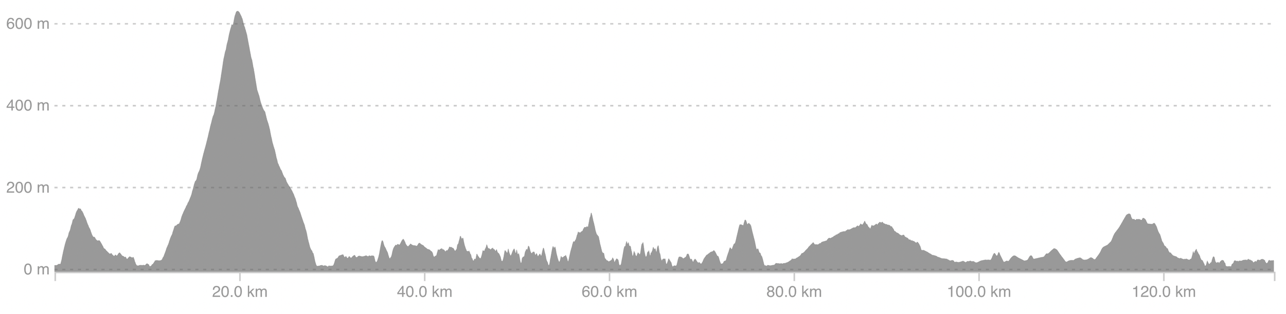
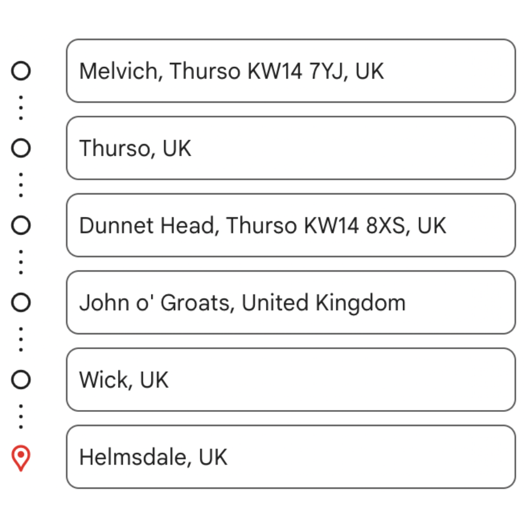
Day 7: Melvich to Helmsdale
Distance: 98 miles / 157 km
Elevation gain: ~950m
Estimated ride time: 6–7 hours (excluding stops)
NC500 Day 7 Cycling Route Elevation
NC500 Day 7 Cycling itinerary

NC500 Day 7 Cycling Map route
🌄 Morning – Melvich to John O’Groats
This stretch begins with fast, quiet roads that hug the northern coastline. While it’s a long day, the gradients are manageable early on, giving you time to warm up your legs. Aim to leave early so you have time to enjoy the big views and coastal detours.
Morning Highlights:
Reay – peaceful village as you head east
Thurso – the northern hub with breakfast spots, supermarkets and a few bike essentials
Dunnet Head – optional 6 km round-trip to the most northerly point of mainland Britain
John O’Groats – snap a photo at the sign and grab a snack
Refuel Options:
Caffé Cardosi (Thurso) – good coffee and breakfast
Stacks Bistro (John O’Groats) – warm food, good prices
John O’Groats convenience shop – decent for topping up snacks
🍽️ Afternoon – John O’Groats to Wick to Helmsdale
From John O’Groats, the route begins to roll south as you join the A99. The road undulates with scenic views of sea cliffs and farmland. This is a good time to settle into a rhythm and enjoy the coastal ride.
Stops to break up the ride:
Wick – excellent mid-point lunch stop with plenty of options
Whaligoe Steps – a brilliant hidden gem; a steep walk, but very rewarding
Lybster – small coastal village for a snack or water refill
Helmsdale – end point for the day
Refuel Options:
No.1 Bistro (Wick) – great for hearty lunches
Wick Tesco Superstore – good for a quick grab-and-go
The Bay Owl Inn (Lybster) – good pub with sea views
🌙 Evening – Rest up in Helmsdale
Helmsdale is a quiet fishing village and a peaceful place to stay after a big ride. Set near the river and cliffs, it’s got a few pubs, a shop, and great views to wind down the day.
Accommodation Options:
Navidale House Hotel – sea views, excellent breakfast, warm welcome
Helmsdale Hostel & Lodge – budget-friendly and cyclist-friendly
Crakaig Loth Campsite – quiet campsite with basic amenities (~£20/night)
Dinner Ideas:
La Mirage – classic fish & chips and comfort food
Thyme & Plaice – hidden gem if you want something a little more refined
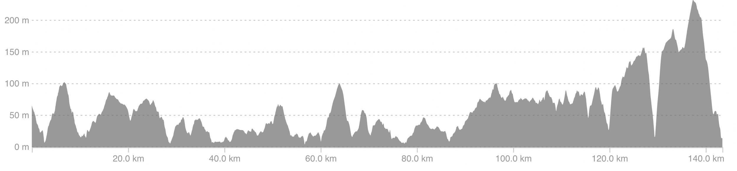
Day 8: Dornoch to Inverness
Distance: 77 miles / 125 km
Elevation Gain: ~950 metres
Estimated Ride Time: 5.5–6.5 hours (7+ with stops)

Day 8 NC500 cycling elevation

NC500 Day 8 Cycling Route Map

NC500 day 8 cycling route itinerary
🌄 Morning – Helmsdale to Dornoch
This stretch flows through soft rolling countryside and picturesque coastal villages. Traffic is usually light, and the morning light on the sea makes for a beautiful final send-off from the far north.
Morning Highlights:
Brora – flat and scenic, ideal for a coffee break
Golspie – detour to Dunrobin Castle if you’re keen
Loch Fleet Causeway – quiet and beautiful ride beside the estuary
Dornoch – great spot for an early lunch
Refuel Options:
Brora Coffee Shop – casual with great views
The Courthouse Café (Dornoch) – relaxed, good cakes and coffee
Luigi’s (Dornoch) – Italian-style lunches with generous portions
🍽️ Afternoon – Dornoch to Inverness
The final leg takes you inland over the Dornoch Firth Bridge, through Tain and alongside the Cromarty Firth. With a bit of rolling terrain and one last push over Tore, the ride finishes back where it all began – Inverness Castle.
Stops to break up the ride:
Tain – historical town with bakeries and shops
Cromarty Bridge – great photo opportunity over the Firth
Tore – final climb before descending into Inverness
🌙 Evening – Finish in Inverness
You did it! 8 days, 500+ miles, and some of the best cycling Scotland has to offer. If time allows, treat yourself to a post-ride meal and enjoy a proper bed and hot shower in town.
Celebration Dinner Options:
The Mustard Seed – hearty meals with riverside views
Black Isle Bar – amazing pizza and craft beer
Velocity Café – cyclist-run café with great food
🎯 Top Tip for Day 8
Don’t underestimate the final stretch, it’s tempting to rush, but this ride is worth savouring. Plan your arrival in Inverness for late afternoon and give yourself time for photos and a celebratory drink.
🚴♀️ NC500 Cycling FAQ: everything you need to know
Planning to cycle the North Coast 500? Here are the most commonly asked questions to help you prepare for one of the UK’s most epic bikepacking adventures.
1. What is the best route for cycling the NC500?
The North Coast 500 cycling route follows the same general loop as the famous driving route — starting and finishing in Inverness — but with a few tweaks that make it more enjoyable (and safer) on two wheels.
Most cyclists choose to ride the NC500 clockwise. This allows you to tackle the most challenging climbs on the west coast earlier in the trip, including the infamous Bealach na Bà, and enjoy flatter roads later on as you return via the east coast.
While the core route sticks to the same roads as drivers, some cyclists choose to detour off busy stretches (like the A9) in favour of quieter backroads, though this does add mileage.
2. How many days does it take to cycle the NC500?
Most cyclists complete the NC500 in 7 to 8 days, averaging around 60–75 miles per day. This allows plenty of time to stop for photos, explore remote beaches, and recover from the hillier west coast sections.
Some ultra-endurance cyclists have completed it in under 28 hours, but for most, a week-long ride offers the best mix of challenge and enjoyment — especially if you're carrying your own kit.
3. Where does the NC500 cycling route start and end?
Just like the driving route, the NC500 cycling route officially begins and ends in Inverness, the capital of the Scottish Highlands. It’s easily accessible by train, road, or air, and is a great place to prepare, stock up, and set off.
4. Is the NC500 signposted for cyclists?
Parts of the NC500 are signposted with brown tourist signs, which help guide the way through towns and villages. However, these are not designed specifically for cyclists, and signposting can be sparse in more remote areas.
To avoid getting lost, we strongly recommend downloading an offline map or GPX file of the route before you go, especially since phone signal can be limited in parts of the Highlands.
5. How hilly is the NC500 for cyclists?
The full NC500 cycling route includes around 9,000–10,000 metres of elevation gain, with the majority of climbing concentrated along the west coast. The stretch between miles 60 and 360 is where you'll tackle the toughest ascents — including the legendary Bealach na Bà, one of the steepest road climbs in Britain.
A lightweight setup and low gearing are highly recommended. While the eastern side of the route is flatter, don’t underestimate the rollers — there’s no such thing as a flat day on the NC500.
6. Where can cyclists stay along the NC500?
There are a growing number of cycling-friendly accommodations along the NC500, including B&Bs, hostels, campsites, and glamping pods.
Highlights include:
Lochcarron: Rockvilla Guest House (bike-friendly with great views)
Achmelvich & Brora: NC500 Pods (beachfront glamping)
Tongue: Kyle of Tongue Hostel & Campsite
John O’Groats: Seaview Hotel (LEJOG favourite)
Inverness: Inverness Youth Hostel & Ardbrae House
Wild camping is also legal in Scotland (with respect), and many cyclists mix both for flexibility and cost. Just make sure to check ahead in peak season (June–August) as accommodation books up quickly.
🌅 Make 2026 the year you drive the NC500
Plan your dream North Coast 500 trip with my downloadable Guide & Interactive Map – packed with routes, scenic stops, accommodation, and local tips from my own adventure. 🚗
You’ll also get a free Google Map with 100+ pinned locations – beaches, cafés, viewpoints and campsites – all ready to open straight from your phone. 📱
Prefer offline planning? Grab the printed hard copy – or get a custom 2026 itinerary built entirely around you. 🗺️
7. How should I train for cycling the NC500?
Whether you're riding self-supported or with van backup, you'll want to be comfortable spending long hours in the saddle. Gradually increase your weekly mileage, including some back-to-back long rides.
If you're nervous about the hills, start incorporating climbs into your training or use a turbo trainer with gradient simulation. The more time you spend riding loaded (if you're bikepacking), the more prepared you’ll be.
8. When is the best time of year to cycle the NC500?
The best time to ride the NC500 is late spring to early autumn — ideally May to September. These months offer longer daylight hours, better weather, and more open attractions.
That said, the Scottish Highlands are famously unpredictable, so come prepared for wind, rain, and sun in the same day. Summer is most popular, but also the busiest, so shoulder season (May or September) often provides the best balance of conditions and availability.
9. How do I get to and from Inverness with a bike?
You’ve got three main options:
Train: Inverness has regular services from Glasgow, Edinburgh, and London (including the Caledonian Sleeper). Be sure to check bike reservation policies before booking.
Plane: Inverness Airport is just 8 miles from the city centre with flights from across the UK.
Drive: If you're starting with support, there’s long-stay parking near Inverness.
Bike shops and supermarkets are all easily accessible in town, making Inverness the ideal start and finish line.
10. Are there bike shops on the NC500 route?
Bike shops are limited along the northern section of the NC500. After Beauly, you won’t find a full-service bike shop again until you get much closer to Thurso or return to Inverness — that’s over 300 miles.
Make sure your bike is in great condition before you go, and carry essential spares like tubes, a chain tool, and a multitool. Confidence in basic roadside repairs is a must.
12. Can you cycle the NC500?
Yes, of course! You can complete the NC500 by bike in as little as 8 days.
NC500 Google Maps, GPX files and Strava map links
To get your hands on my links and GPX files, please signup for my newsletter below. You’ll need to tick ‘Sign up for news and updates’ too. My NC500 newsletter is made up of helpful content, tips and recommendations to help plan your NC500 trip and is made up of several emails. You can unsubscribe at any time.
Read my other NC500 Travel guides and resources


North Coast 500
〰️
North Coast 500 〰️